> ## Content Index
> Fetch the complete content index at: https://blog.jharrisonphoto.com/llms.txt
> Use this file to discover other available public pages before exploring further.
# 9 Things I Wish Every Point Lobos Visitor Knew: After 30 Years of Photographing It
- URL: https://blog.jharrisonphoto.com/point-lobos-things-to-do/
- Published: 2026-09-13T21:50:27.000Z
- Updated: 2026-09-13T21:50:27.000Z
- Description: After 30 years of photographing Point Lobos, these are the places, trails, wildlife encounters and small details I wouldn't miss—from Weston Beach and China Cove to Cypress Grove, Bird Island and the tide pools.
- Author: John Harrison
- Tags: California Coast, Point Lobos, California Travel, Interior Design, Big Sur
**Point Lobos might be the best stop you're tempted to rush past on your way to Big Sur.**
**Big Sur Travel Update — September 2026:** Point Lobos State Natural Reserve is currently open, while ongoing wildfire activity farther south in Big Sur has affected access to several parks and sections of Highway 1\. If Point Lobos is part of a larger Big Sur trip, check current California State Parks and road conditions before leaving. Conditions can change quickly.
Just south of Carmel-by-the-Sea, Point Lobos State Natural Reserve packs an extraordinary amount of California coastline into a remarkably small area: turquoise coves, crashing Pacific surf, hidden beaches, tide pools, sea otters, harbor seals, windswept Monterey cypress and some of the most fascinating coastal geology I've photographed anywhere in California.
I've been photographing Point Lobos and California's coastline for more than 30 years, and I still discover something new almost every time I return.
On my latest visit this summer, I arrived just after the gates opened and spent **nine hours exploring the reserve**. I photographed crabs hiding in tide pools, revisited the colorful rocks of Weston Beach where some of my favorite Point Lobos photographs were created, walked miles of coastal trails, watched wildlife offshore and once again discovered that Point Lobos rewards you most when you don't rush through it.
[](https://www.jharrisonphoto.com/Landscapes/Point-Lobos-Photography/i-sQjcXVs?ref=blog.jharrisonphoto.com)
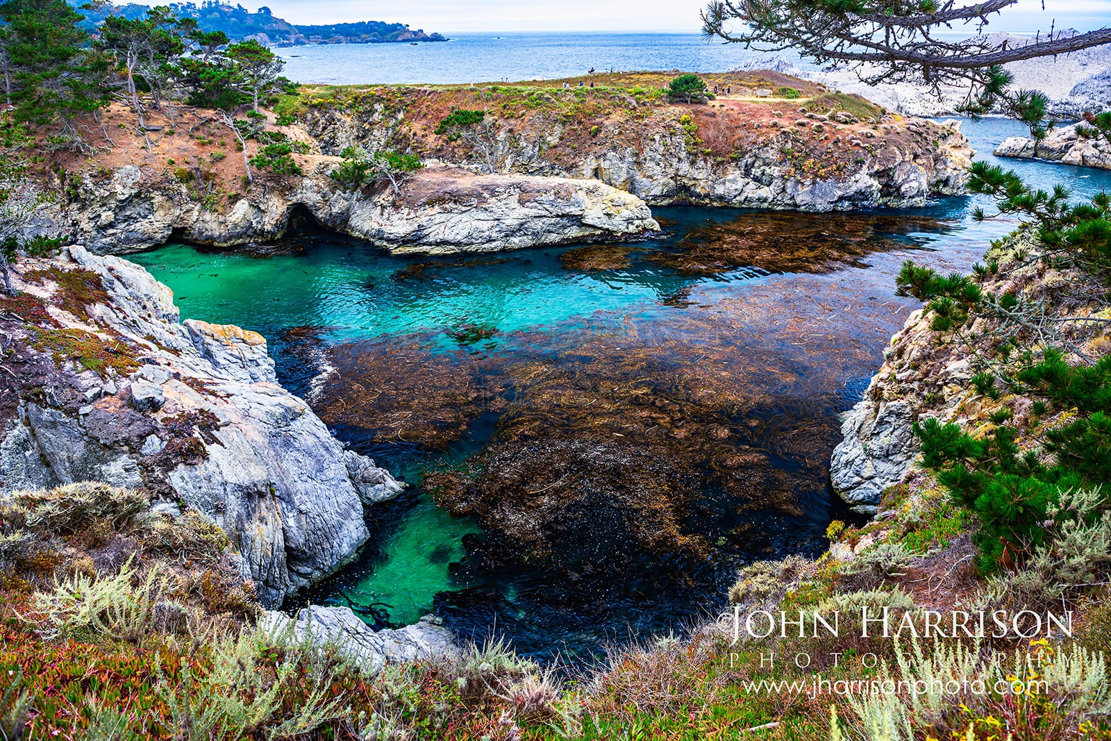
****Turquoise water and kelp forests below China Cove at Point Lobos.**
If you're planning a Highway 1 road trip from Carmel toward Bixby Bridge and Big Sur, don't treat Point Lobos as another quick scenic overlook.
**Give it a few hours. Better yet, give it a day.**
This guide shares some of my favorite places, small details and lessons I wish every first-time visitor knew—from when to explore tide pools to the trails I'd never skip.
Many of the landscape photographs featured in this guide are also available as museum-quality fine art prints for homes, offices, hospitality and healthcare spaces.
[1\. Give It More Time](#how-long-point-lobos) [2\. Plan Your Visit + Map](#planning-your-visit) [3\. Arrive Early](#arrive-early) [4\. Check the Tides](#check-the-tides) [5\. Weston Beach — My Favorite](#weston-beach) [6\. China Cove + Bird Island](#china-cove-bird-island) [7\. Cypress Grove & Old Veteran](#cypress-grove) [8\. Sea Lion Point](#sea-lion-point) [9\. Talk to the Docents](#point-lobos-docents) [Point Lobos FAQ](#point-lobos-faq)
---
## Planning a Visit to Point Lobos? Start Here
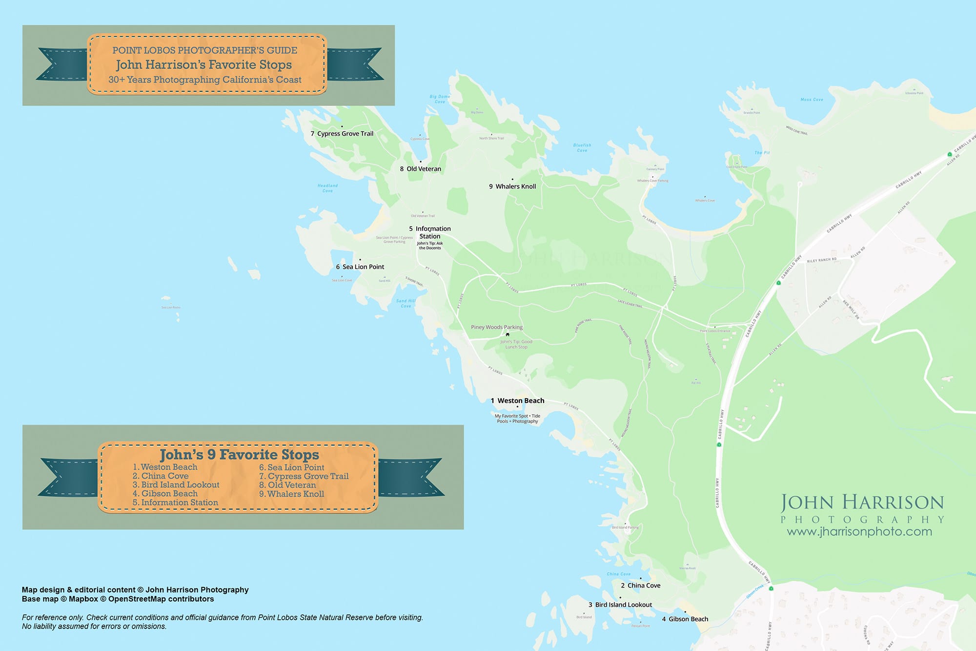
A little planning can make a surprisingly big difference at Point Lobos—especially during busy weekends. Before heading out on the trails, here's a quick overview of what to expect and how to make the most of your visit.
[](https://www.jharrisonphoto.com/Landscapes/Point-Lobos-Photography?ref=blog.jharrisonphoto.com)
****My Point Lobos visitor map highlights nine of my favorite places after more than 30 years photographing this remarkable stretch of the California coast—plus a few parking, picnic and visitor tips.**
**Need more trail detail?** My map is designed as a visual visitor guide, not for navigation. For trail descriptions, distances and accessibility information, use the [**official Point Lobos Foundation trail guide**](https://www.pointlobos.org/trails/?ref=blog.jharrisonphoto.com)**.**
### Point Lobos at a Glance
• **Location:** Highway 1, just south of Carmel-by-the-Sea
• **Best for:** Coastal hiking, wildlife, tide pools and photography
• **Time needed:** 2–4 hours for the highlights; a full day for photographers and nature lovers
• **When to arrive:** At opening on busy weekends and during peak season
• **Don't miss:** China Cove, Bird Island Trail, Sea Lion Point, Cypress Grove and the Old Veteran
• **Tide pools:** Time Weston Beach around low tide if tide-pool exploring is a priority
• **Bring:** Water, food, layers, comfortable shoes, binoculars and a camera
• **Continuing south:** Garrapata State Park, Rocky Creek Bridge, Bixby Bridge and Big Sur
**Visiting in Fall:** September and early fall can be one of my favorite times at Point Lobos. The summer marine layer often gives way to clearer mornings and pleasantly warm afternoons, while cool ocean breezes make layers worth bringing.
[](https://www.jharrisonphoto.com/Landscapes/Point-Lobos-Photography/i-VQrSdSP?ref=blog.jharrisonphoto.com)
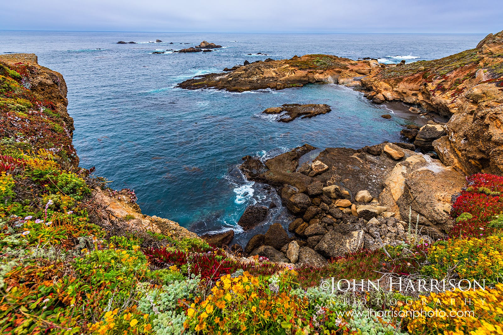
****Wildflowers blanket the cliffs above Sea Lion Cove at Point Lobos, where Pigeon Guillemots fly below and the calls of sea lions carry across the Pacific.**
---
## Arrive Early to Point Lobos! Parking Fills Fast
This is probably the most important practical advice I can give anyone visiting Point Lobos during peak times.
**Don't just arrive early. Arrive at opening.**
[](https://www.jharrisonphoto.com/Landscapes/Point-Lobos-Photography/i-WR6HBfN?ref=blog.jharrisonphoto.com)
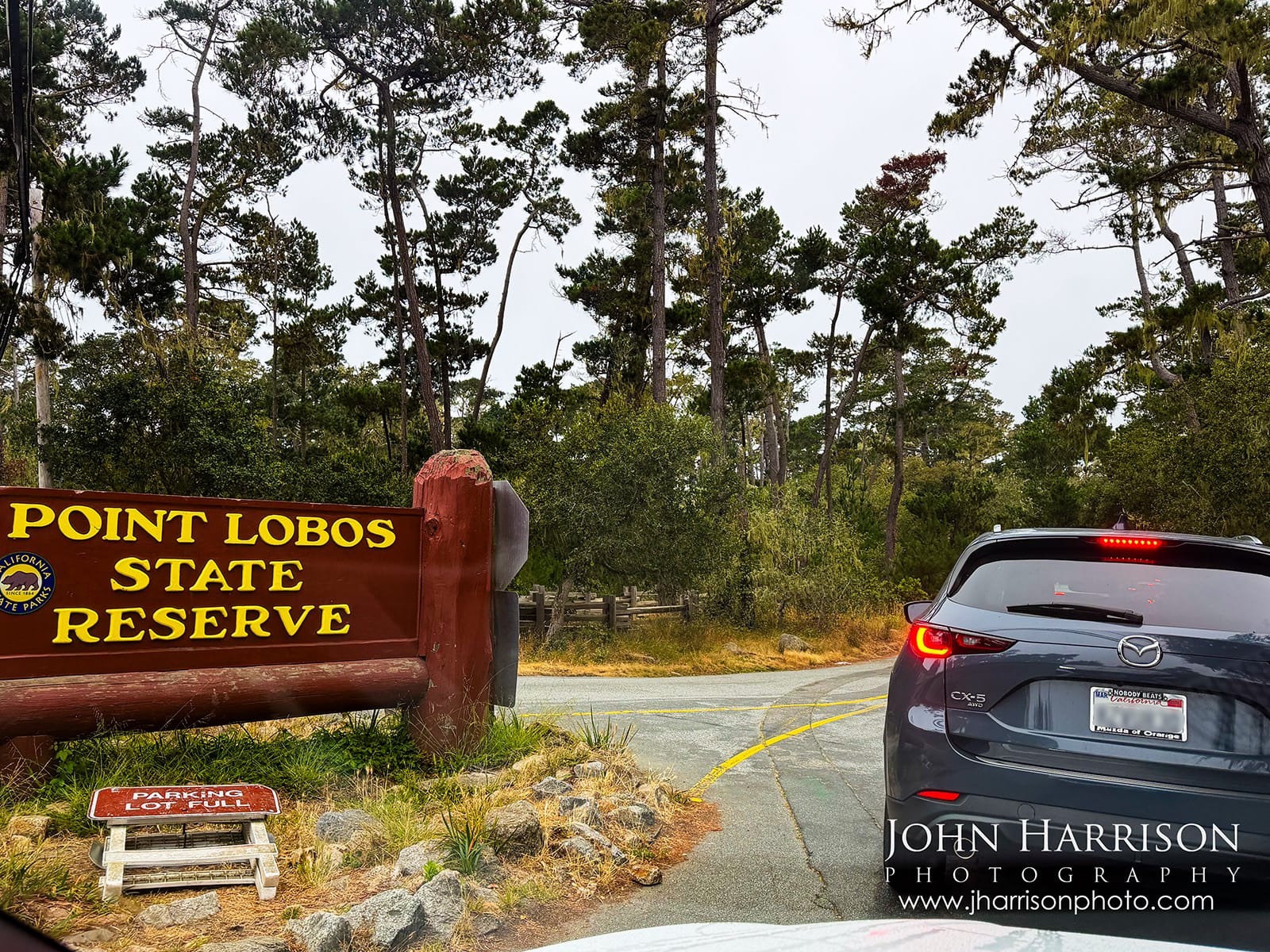
***8:10 AM at Point Lobos—and the “Parking Lot Full” sign was already waiting to go up. Arrive early!**
On my latest visit, I entered around **8:10**, barely after the gates opened.
There were only five or six cars ahead of me, so I assumed parking would be easy.
**It wasn't.**
I drove through several parking areas before finally finding one of the few remaining spaces. Once I had it, I left the car there for most of my nine-hour visit and explored on foot.
**If you're visiting on a weekend or holiday, I'd plan your morning around Point Lobos rather than trying to squeeze it between other Highway 1 stops.**
Later in the afternoon, parking began opening as morning visitors departed. Toward the end of my day, I was finally able to move the car and return to the China Cove area. **That worked remarkably well.**
During my visit, it did not appear that additional cars were being let in each time a parking space opened, so I wouldn't count on simply waiting outside for a spot. There is also parking along Highway 1 outside the reserve, but be prepared for a substantial walk—and use extra caution when parking or walking along the highway.
**John's Tip:** Once you find a good parking space on a busy day, **treat it like gold!** Put on your walking shoes, grab your water and camera, and explore.
---
## Check the Tides Before You Visit
One of the biggest lessons from my latest Point Lobos visit had nothing to do with photography gear.
It was the tide.
[](https://www.jharrisonphoto.com/Landscapes/Point-Lobos-Photography/i-GNc8J2g?ref=blog.jharrisonphoto.com)
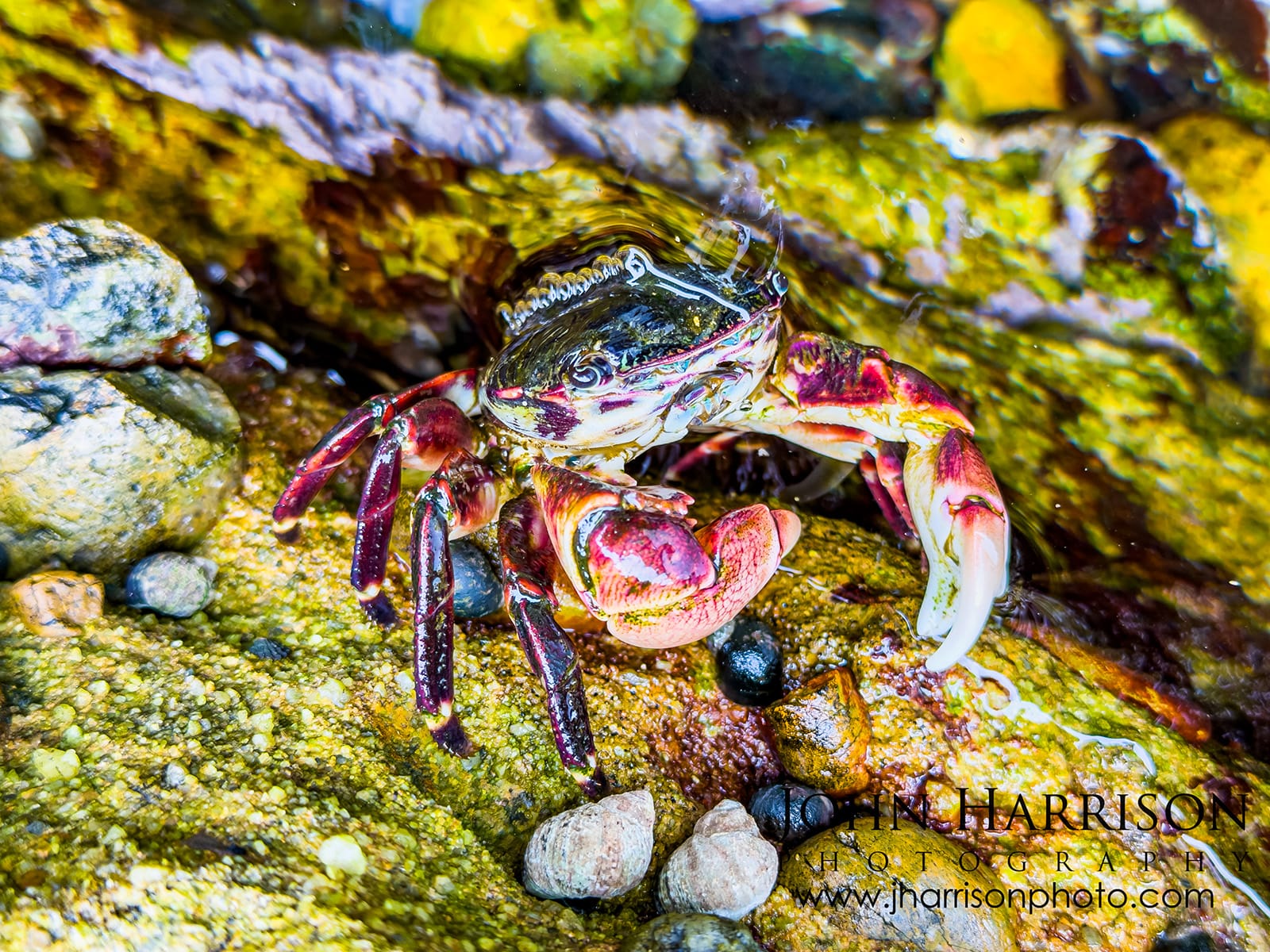
****Low tide reveals another world at Weston Beach, including colorful shore crabs hiding among the rocks and tide pools captured on my iPhone 17 Pro Max**
I happened to visit around **low tide**, and parts of the rocky shoreline revealed an entirely different world. Several websites provide tide tables, including [Monterey, California from NOAA](https://tidesandcurrents.noaa.gov/map/index.html?id=9413450&ref=blog.jharrisonphoto.com).
At Weston Beach, receding water exposed tide pools and crevices filled with marine life. I spent far more time than expected watching and photographing a little group of crabs tucked among the rocks.
If your schedule is flexible, check the tide tables before deciding when to explore the shoreline**.**
A lower tide exposes areas and compositions that simply aren't visible several hours later. For photographers, it can completely change the landscape.
Remember that this is still the Pacific Ocean. Wet rocks can be extremely slippery and unexpected waves are dangerous. Never turn your back on the water.
---
## My Favorite One-Day Point Lobos Walking Route
There really isn't a wrong way to explore Point Lobos, but **where you park and what the tide is doing when you arrive can shape your entire day.**
Before heading out, check the tide schedule. If **low tide is in the morning**, I'd prioritize Weston Beach early. If the tide is better later, use the quieter morning hours for China Cove, Bird Island or another section of the reserve and work Weston Beach into your day around low tide.
On my latest visit, I parked at Piney Woods parking and started there because the tide was favorable and I knew I wanted plenty of time to explore the rocks and tide pools. From there, I spent much of the day working my way along the coastline toward Sea Lion Point, Cypress Grove and eventually Whalers Knoll.
I also planned **lunch as part of the day**, rather than returning to the car or leaving the reserve. Bring food and water, find a good place to stop along your route, and enjoy the coastline for a while. Point Lobos is much better when you aren't rushing from one location to the next.
Toward the end of my nine-hour visit, I returned to my car. By then, parking had started opening up, so I was able to drive through the southern part of the reserve and return toward China Cove for one final exploration.
For a full day, I'd suggest something roughly like this:
- **Arrive at opening and secure parking inside the reserve.**
- **Check the tides** and, if timing works, **explore Weston Beach around low tide**—and don't rush it.
- Continue toward **Sea Lion Point** and explore the coastal trails.
- Stop at the **Information Station** and talk with the docents.
- Bring lunch and find a scenic place to take a real break.
- Walk the **Cypress Grove Trail**, then make the short detour to the **Old Veteran (don't forget this!)**
- Visit **China Cove and Bird Island Trail** when they fit naturally into your route—early morning is especially nice if the tide timing doesn't send you to Weston Beach first.
- Continue toward **Whalers Knoll** if you still have the time and energy (I would prioritize China Cove and Bird Island before this).
- Late in the day, if parking has opened up, consider moving the car and **revisiting a favorite location** before leaving.
The important part isn't following an exact itinerary.
**It's not trying to experience Point Lobos from your car.**
---
## Weston Beach (John's Favorite Spot!): Where I Could Spend Hours
[](https://www.jharrisonphoto.com/Landscapes/Point-Lobos-Photography/i-MrgBTv7?ref=blog.jharrisonphoto.com)
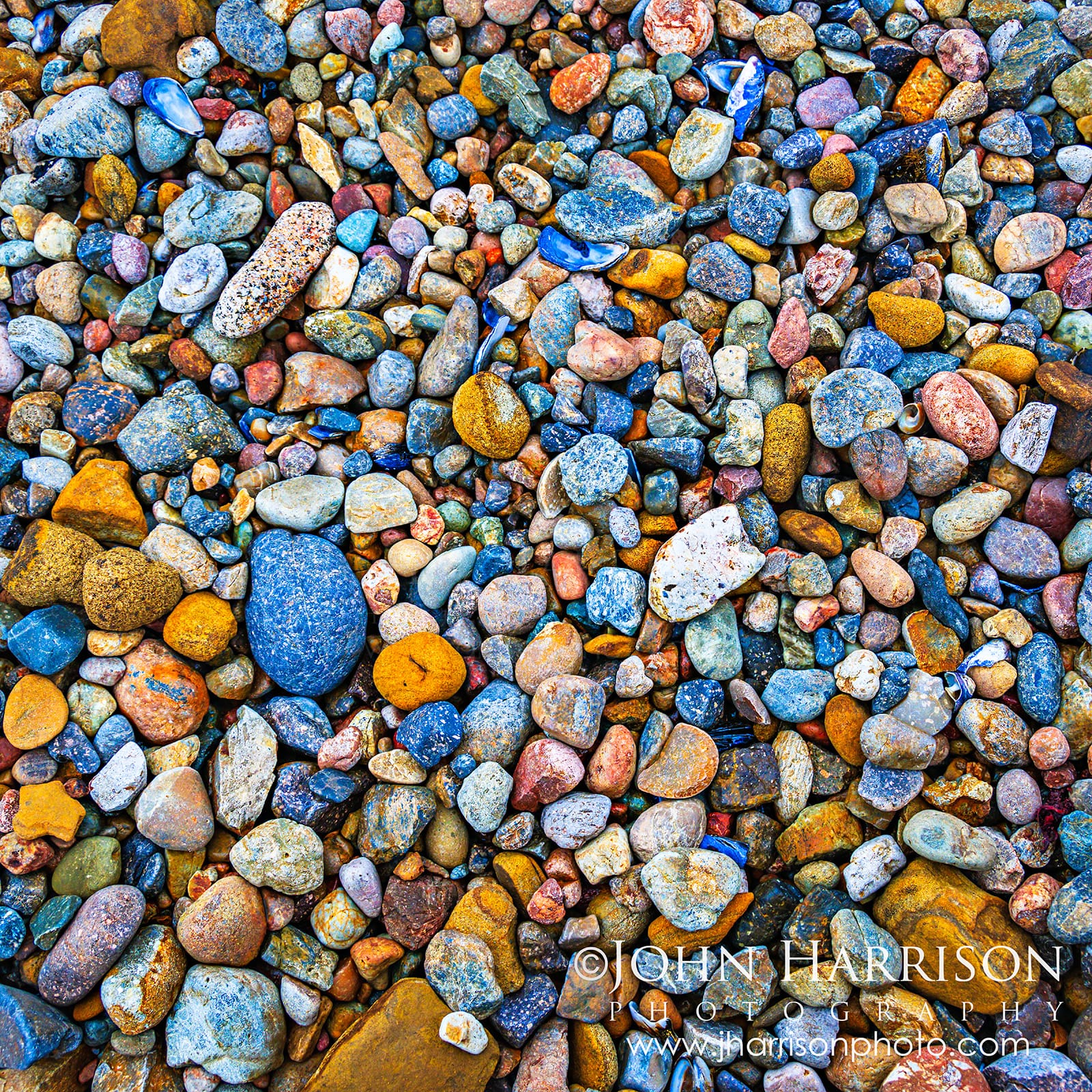
****"Sea of Pebbles" - Colorful wave-polished pebbles at Weston Beach, one of my favorite details at Point Lobos.**
If you gave me only one location to photograph at Point Lobos, I'd choose **Weston Beach**.
Not because it has the biggest view.
Quite the opposite.
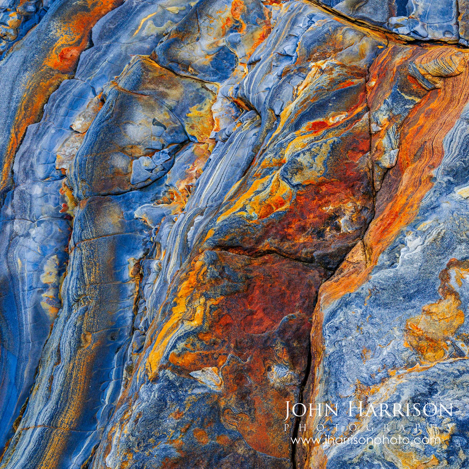
This shoreline taught me to stop looking toward the horizon, revealing extraordinary geological formations and colors. Blue-gray rock intersects with rust, ochre, cream and gold. Colorful pebbles collect in crevices. Water polishes the surfaces and temporarily transforms their colors.
Move the camera a few inches and an entirely new composition appears.
[](https://www.jharrisonphoto.com/Landscapes/Point-Lobos-Photography/i-FqjtZvX?ref=blog.jharrisonphoto.com)
****Earth’s Etchings | Weston Beach, Point Lobos** — Completely natural layers of slate blue, rust, orange and gold transform the rocks of Weston Beach into an abstract work of art.
This intimate stretch of Point Lobos is part of a remarkable photographic legacy. The beach was named for Edward Weston, who spent roughly two decades photographing the reserve’s rocks, kelp, trees and intimate coastal details, the beach was officially named in his honor in 1979 after a proposal by Ansel Adams. Landscape painter Francis McComas famously described Point Lobos as the “*greatest meeting of land and water in the world.*”
Standing here, that history makes sense to me.
But what keeps bringing me back isn't what previous artists discovered.
It's wondering what **I haven't discovered yet.**
---
## Sea of Pebbles & Entrance to the Stones in Concert
[](https://www.jharrisonphoto.com/Landscapes/Point-Lobos-Photography/i-Mp7nPk6?ref=blog.jharrisonphoto.com)
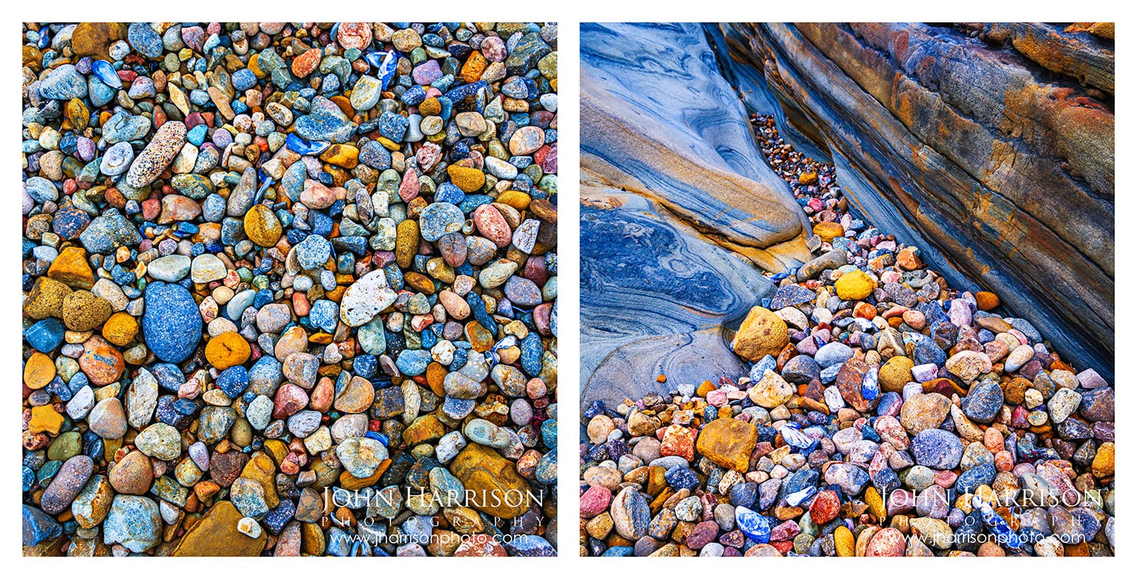
***Sea of Pebbles and Entrance to the Stones in Concert — two signature Weston Beach photographs designed to be displayed together.**
Sometimes an entire landscape can exist within just a few square feet.
Here, thousands of wave-polished stones in blues, golds, rusts, grays, and pinks create naturally occurring abstract compositions. **Weston Beach at Point Lobos | Sea of Pebbles** has become one of the signature works in my Point Lobos Collection. The longer you look, the less it feels like a photograph of a beach and the more it becomes a study of color, shape, and texture.
Nearby, sweeping rock formations guide the eye toward pockets of those same colorful stones. That visual journey inspired **Entrance to the Stones in Concert**.
I've always felt these two photographs belong together. **Sea of Pebbles** explores the stones themselves, while **Entrance to the Stones in Concert** feels like the path leading into their world.
[](https://www.jharrisonphoto.com/Other/Corporate-fine-art-installations/i-Zz4v6Zj/A?ref=blog.jharrisonphoto.com)
***Sea of Pebbles** **and** ***Entrance to the Stones in Concert** **— two collector favorites from Point Lobos, paired to showcase the extraordinary colors, textures and details of Weston Beach.**
The pair became pillar images in my California photography installation at the **Rok Bistro in Silicon Valley**, where they were displayed together for years. They remain among my favorite Point Lobos works—and a pairing I especially love for collectors who want to bring the colors, textures, and quieter details of California's coastline into a space.
---
## When Nature Does the Painting
[](https://www.jharrisonphoto.com/Landscapes/Point-Lobos-Photography/i-GjvhWQG?ref=blog.jharrisonphoto.com)
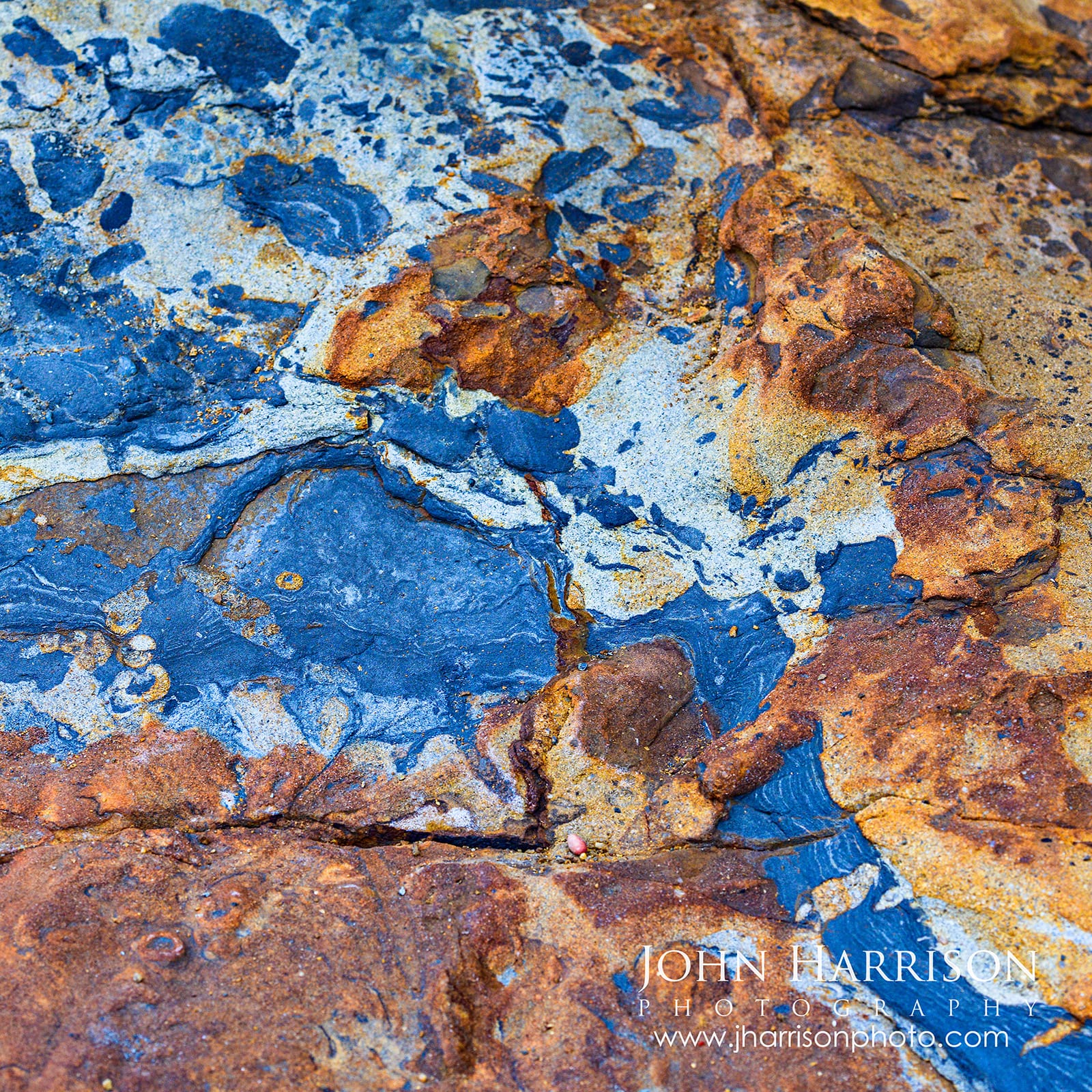
****Painted by Nature — natural blue, rust, gold and ochre rock textures at Weston Beach in Point Lobos State Natural Reserve.**
**Painted by Nature** and **Nature’s Palette** are two of my favorite examples of how Weston Beach turns geology into abstract art.
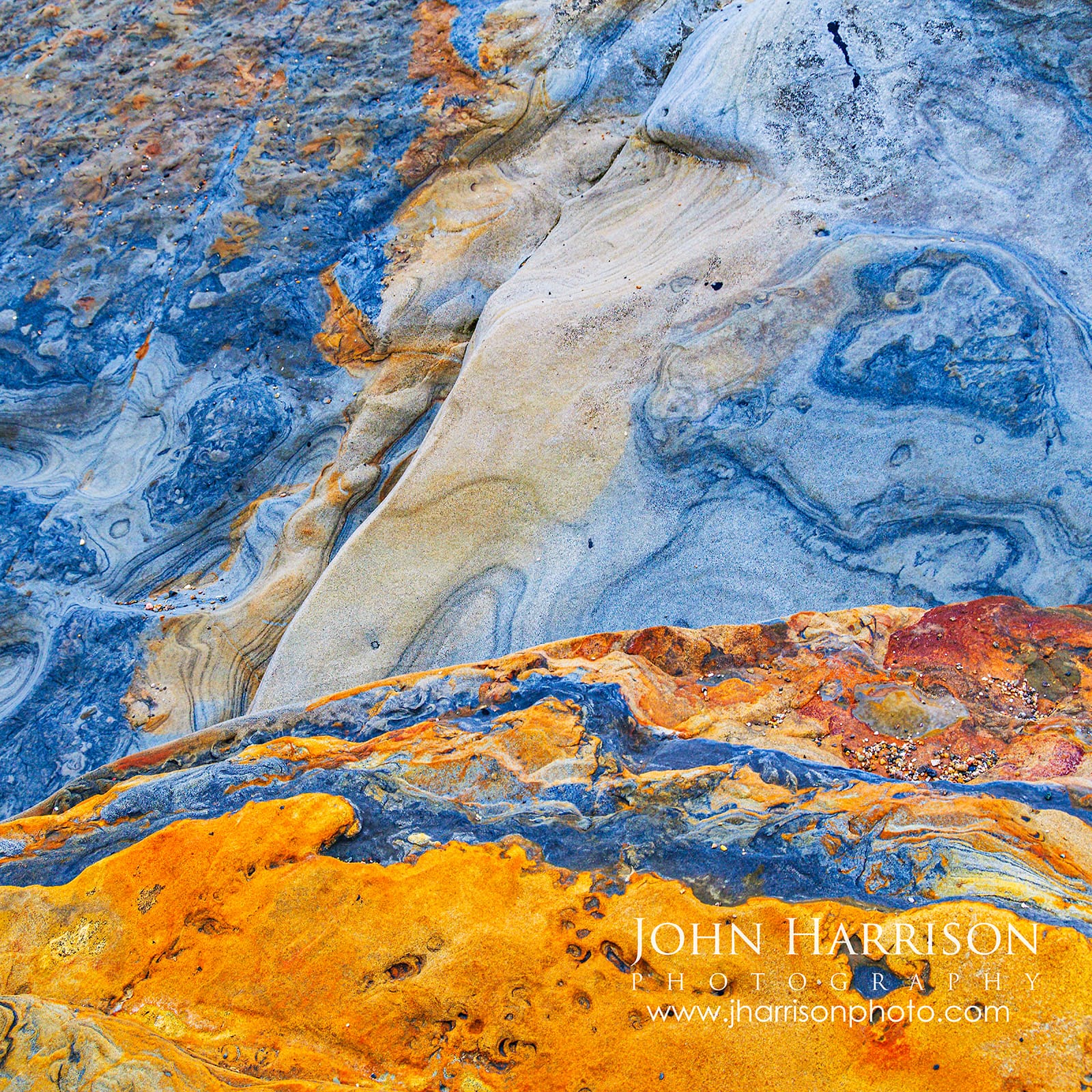
In *Painted by Nature*, cool blue-gray stone collides with rust, ochre and gold. *Nature’s Palette* takes that idea in a slightly different direction, with sweeping layers of blue, cream, orange and warm earth tones that almost look brushed onto the rock.
[](https://www.jharrisonphoto.com/Landscapes/Point-Lobos-Photography/i-8CP4dQB?ref=blog.jharrisonphoto.com)
****The square composition of** ***Nature’s Palette** **, designed to pair with** ***Earth’s Etchings** **and other photographs from my Rock Textures at Point Lobos series.**
Remarkably, these colors are entirely natural.
After more than three decades photographing California’s coastline, what keeps bringing me back is how differently this place reveals itself each time. I can return to the same few yards of rock and discover an entirely new composition.
**Eventually, the location almost disappears. The patterns themselves become nature's paintings.**
Printed as Giclée canvas, both images take on an especially painterly quality, which is one reason I love them for collector pairings and interior spaces.
**This way of seeing isn't unique to Point Lobos.** In Yosemite, I often find myself doing the same thing—looking beyond the grand landscape for abstract compositions hidden in water, light, reflections and rock. I explore that idea further in my [**Water, Light & Textures of Yosemite**](https://blog.jharrisonphoto.com/water-light-textures-yosemite-fine-art-el-capitan-bridalveil/) series.
[Explore Point Lobos Fine Art Prints → ](https://www.jharrisonphoto.com/Landscapes/Point-Lobos-Photography?ref=blog.jharrisonphoto.com) [Get New Photography Stories & Releases → ](#/portal/signup)
---
## China Cove & Bird Island
[](https://www.jharrisonphoto.com/Landscapes/Point-Lobos-Photography/i-FxtJMH6?ref=blog.jharrisonphoto.com)
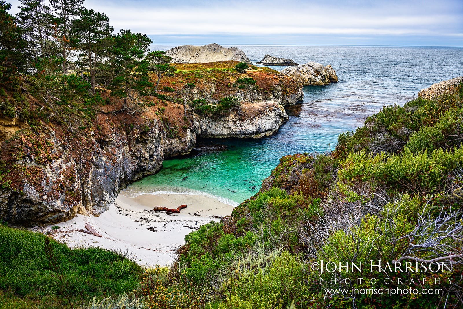
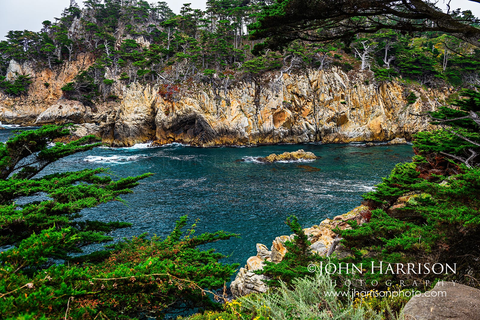
****China Cove at Point Lobos, where turquoise water, a secluded white-sand beach and rugged coastal vegetation lead the eye toward Bird Island.**
If Weston Beach encourages you to look down, China Cove makes you look outward again.
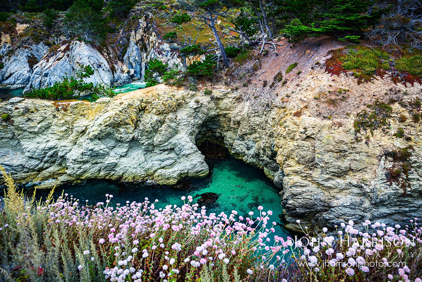
Turquoise water sits beneath rugged cliffs and coastal vegetation, creating one of the most beautiful larger landscapes in Point Lobos.
Nearby, Bird Island Trail combines coastal scenery with excellent opportunities for wildlife viewing.
[](https://www.jharrisonphoto.com/Landscapes/Point-Lobos-Photography/i-4KntFB3?ref=blog.jharrisonphoto.com)
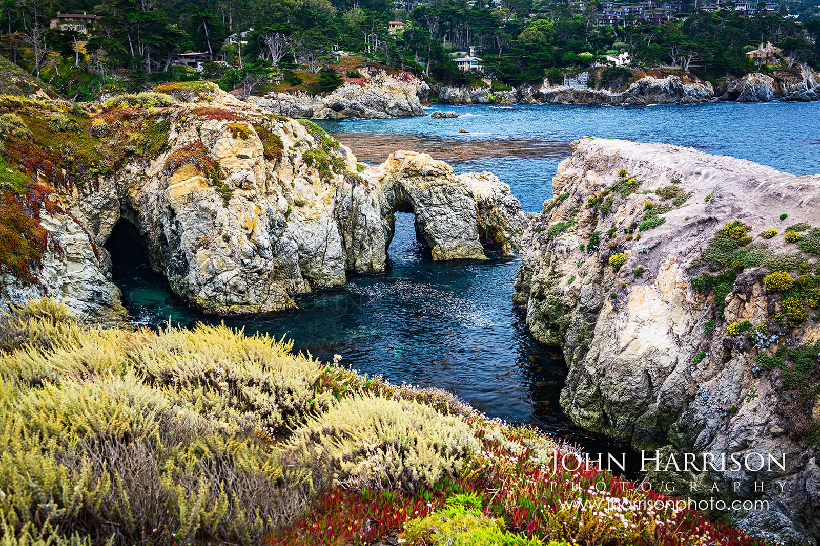
****Natural rock arches and rugged coastline along the Bird Island Trail near Pelican Point, with the coast toward Gibson Beach beyond.**
And yes...
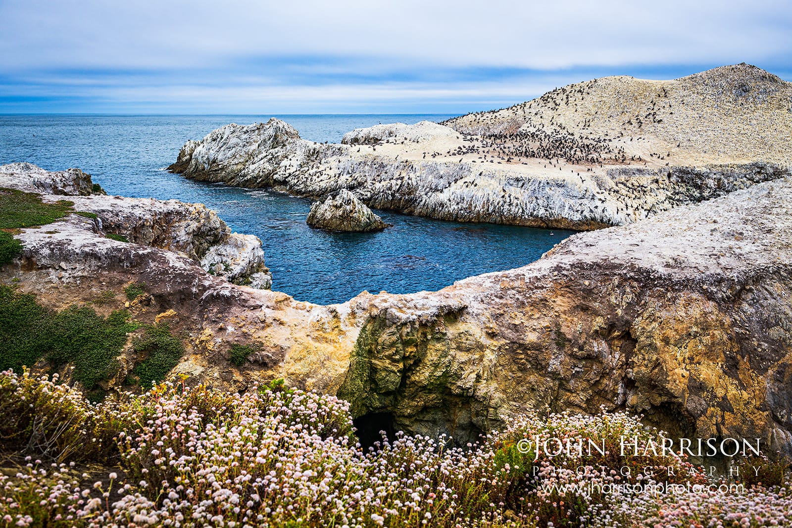
**They don't call it Bird Island for nothing.**
You'll probably smell it. 😂
[](https://www.jharrisonphoto.com/Landscapes/Point-Lobos-Photography/i-tF4FZgb?ref=blog.jharrisonphoto.com)
****Thousands of seabirds cover Bird Island at Point Lobos, framed by Pacific waters and coastal wildflowers along the Bird Island Trail.**
The birds create an unmistakable aroma, but that's part of experiencing a living coastal reserve rather than simply another scenic viewpoint.
Keep a longer lens accessible here rather than buried in your camera bag.
[](https://www.jharrisonphoto.com/Landscapes/Point-Lobos-Photography/i-cJFwDkP?ref=blog.jharrisonphoto.com)
****Turquoise water, coastal wildflowers and rugged cliffs along the trail between China Cove and Bird Island at Point Lobos.**
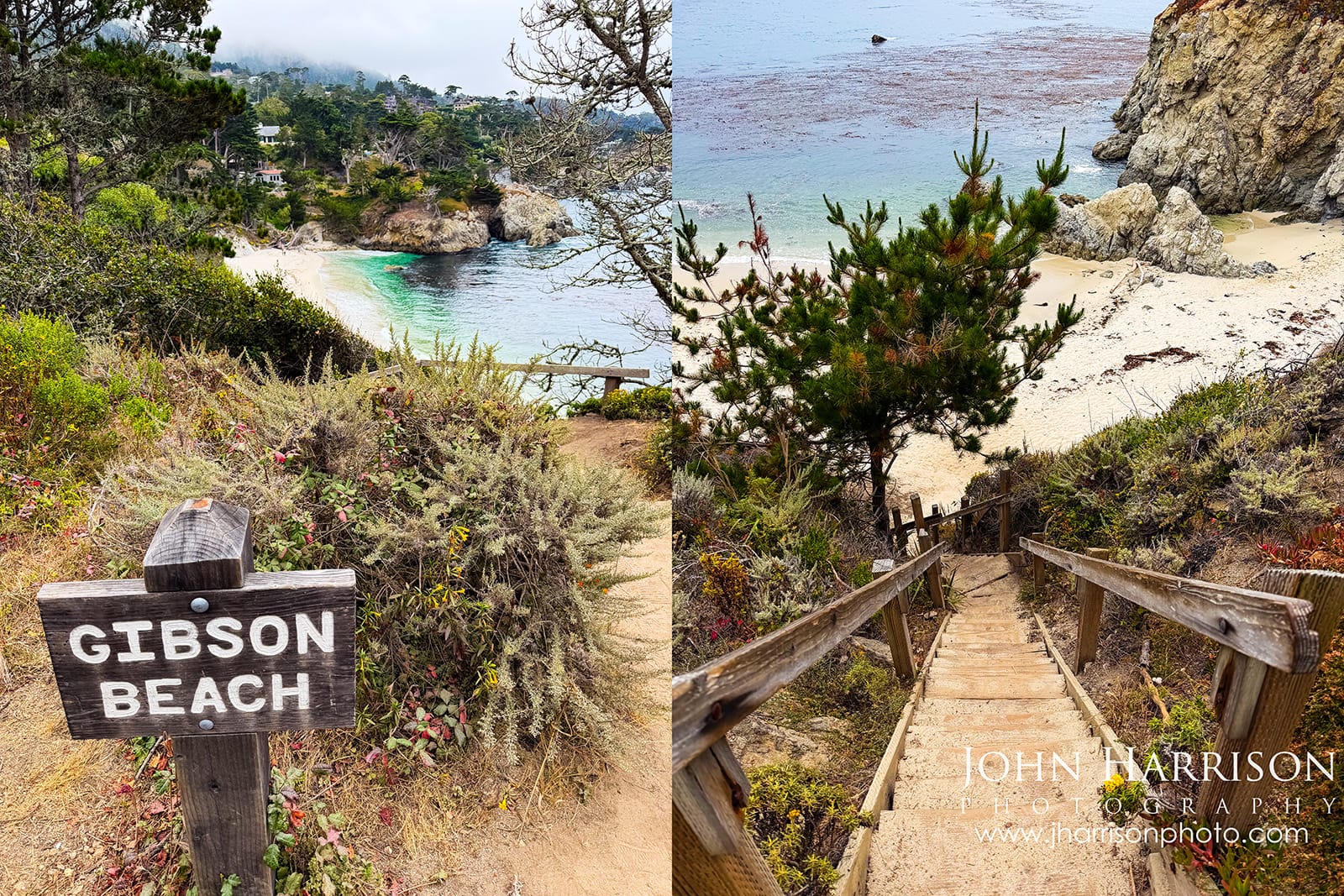
On your way back from the Bird Island Trail loop, **don’t miss the trail down to Gibson Beach** for a beautiful, secluded stretch of coastline. **John’s Tip:** The wooden steps are steep and worn, but the trip down is well worth it!
[](https://www.jharrisonphoto.com/Landscapes/Point-Lobos-Photography/i-pnpDfzp?ref=blog.jharrisonphoto.com)
***Gibson Beach at Point Lobos — look for the trail sign, and be prepared for the steep staircase down to this beautiful secluded beach.**
---
## Cypress Grove Trail - And Don't Miss Old Veteran
[](https://www.jharrisonphoto.com/Landscapes/Point-Lobos-Photography/i-6TskbKc?ref=blog.jharrisonphoto.com)
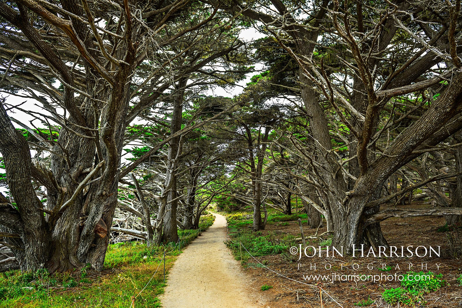
****Follow the Cypress Grove Trail beneath twisting Monterey cypress trees and some of Point Lobos' most beautiful coastal views are waiting just ahead.**
Cypress Grove feels like you've entered another Point Lobos entirely.
[](https://www.jharrisonphoto.com/Landscapes/Point-Lobos-Photography/i-qfxnsts?ref=blog.jharrisonphoto.com)
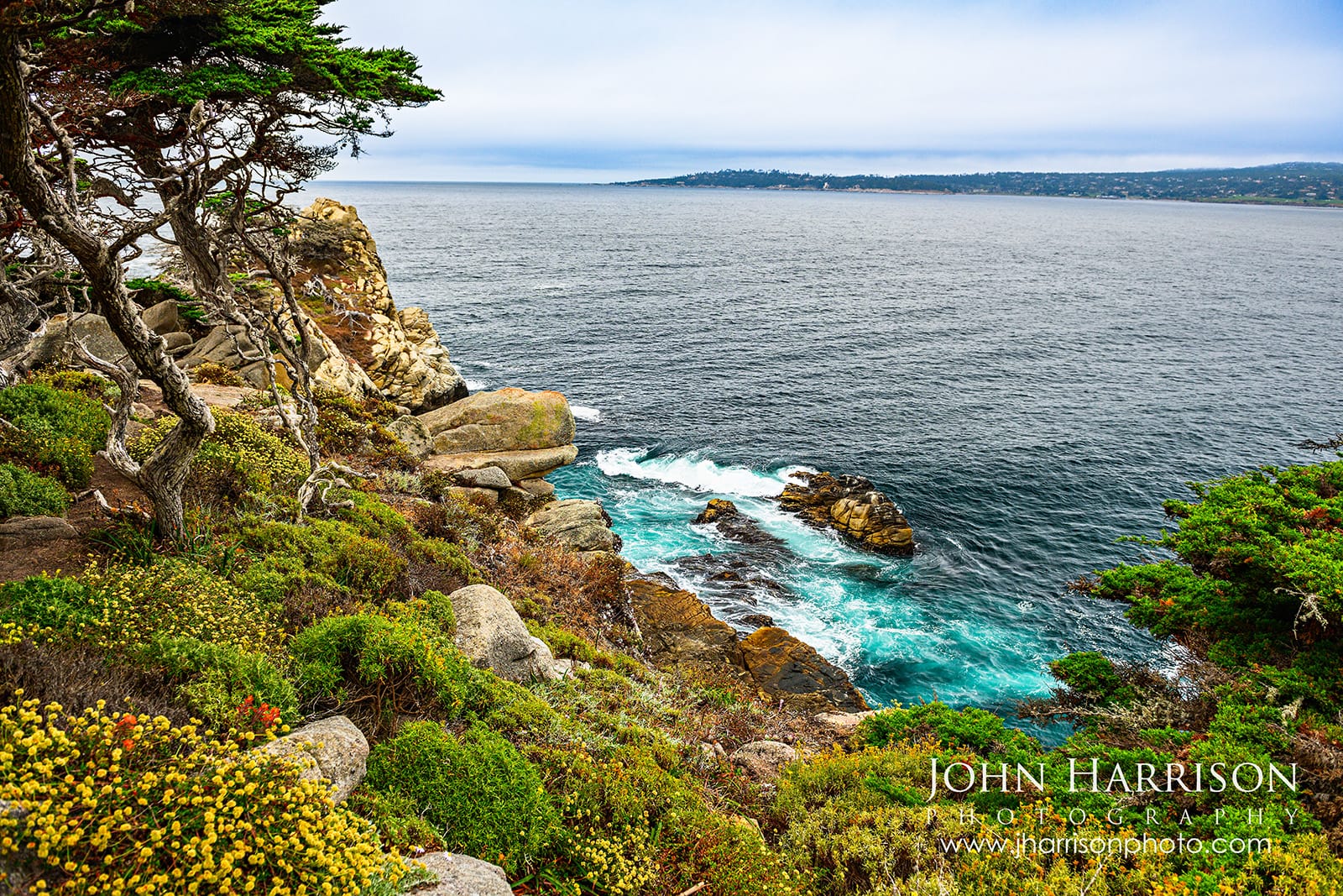
****Monterey cypress frame the rugged cliffs and blue-green Pacific along the Cypress Grove Trail at Point Lobos.**
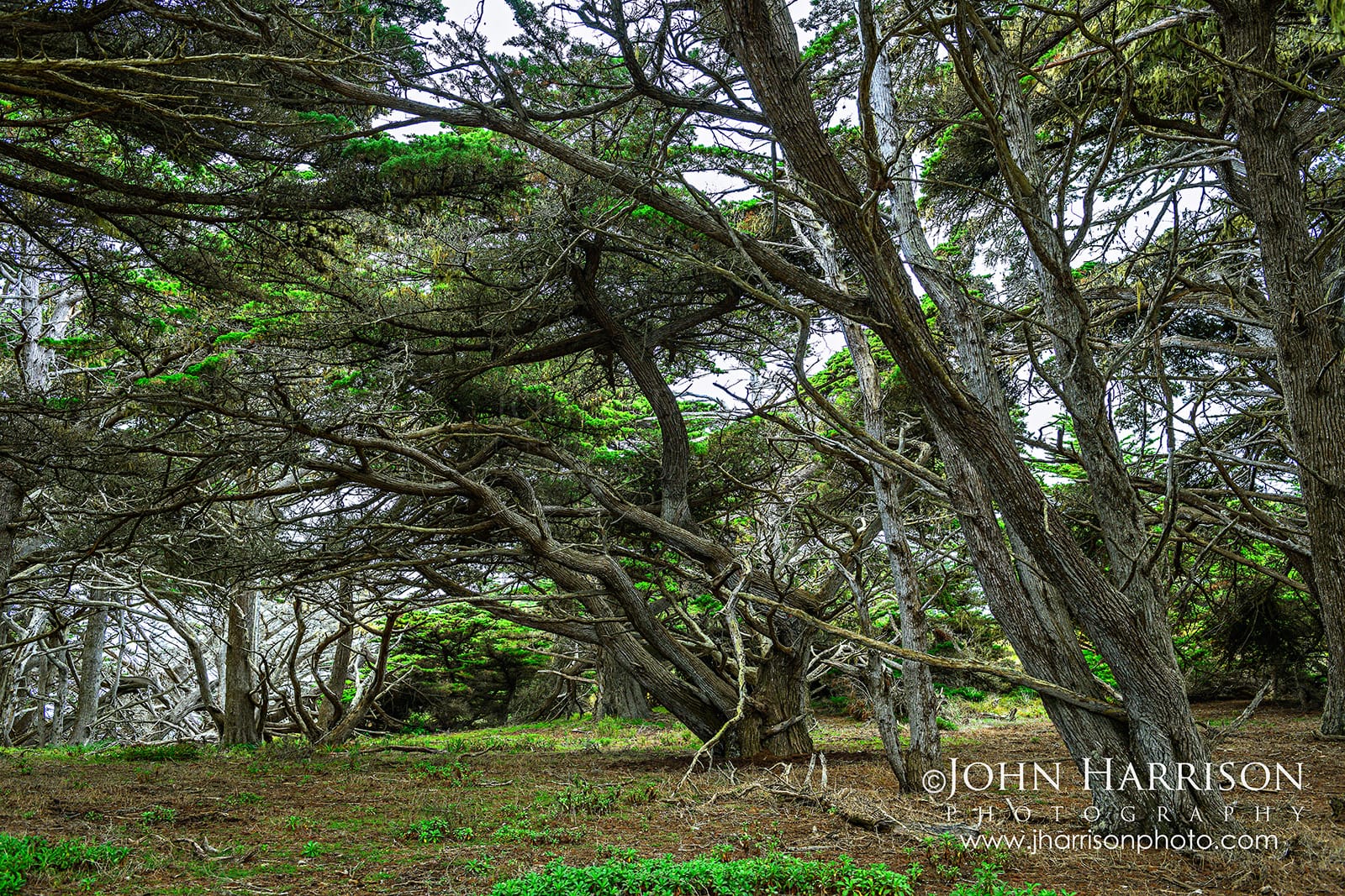
The trail passes among native Monterey cypress shaped by decades of Pacific wind, salt and fog before opening onto dramatic ocean overlooks.
And if the famous California sunshine doesn't appear?
[](https://www.jharrisonphoto.com/Landscapes/Point-Lobos-Photography/i-zWcTmzx?ref=blog.jharrisonphoto.com)
****Weathered Monterey cypress trees create a natural canopy along the Cypress Grove Trail at Point Lobos.**
Don't put the camera away.
**Fog is part of Point Lobos.**
[](https://www.jharrisonphoto.com/Landscapes/Point-Lobos-Photography/i-QhwMxts?ref=blog.jharrisonphoto.com)
****Cypress and Pacific waters meet along the spectacular coastline of Point Lobos, California.**
It simplifies backgrounds, softens the coastline and adds atmosphere around the cypress trees.
Overcast conditions can also be fantastic for photographing rock textures and intimate coastal details without the harsh shadows created by direct sun.
For photographers especially, blue skies aren't always better skies.
[](https://www.jharrisonphoto.com/Landscapes/Point-Lobos-Photography/i-CVn8fGB?ref=blog.jharrisonphoto.com)
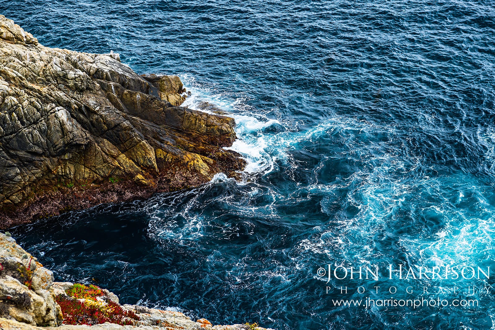
****Look down from the Cypress Grove Trail near Pinnacle Cove and the Pacific becomes an abstract of deep blue water, turquoise currents and white foam swirling against the rocks below.**
## The Old Veteran — Don't Miss This Monterey Cypress
One of the highlights near the Cypress Grove Trail is surprisingly easy to miss if you don't know where to look.
Known as **The Old Veteran**, this extraordinary Monterey cypress clings to the rocky cliffs above Cypress Cove, its exposed roots gripping the stone while centuries of Pacific winds have sculpted its trunk and branches.
[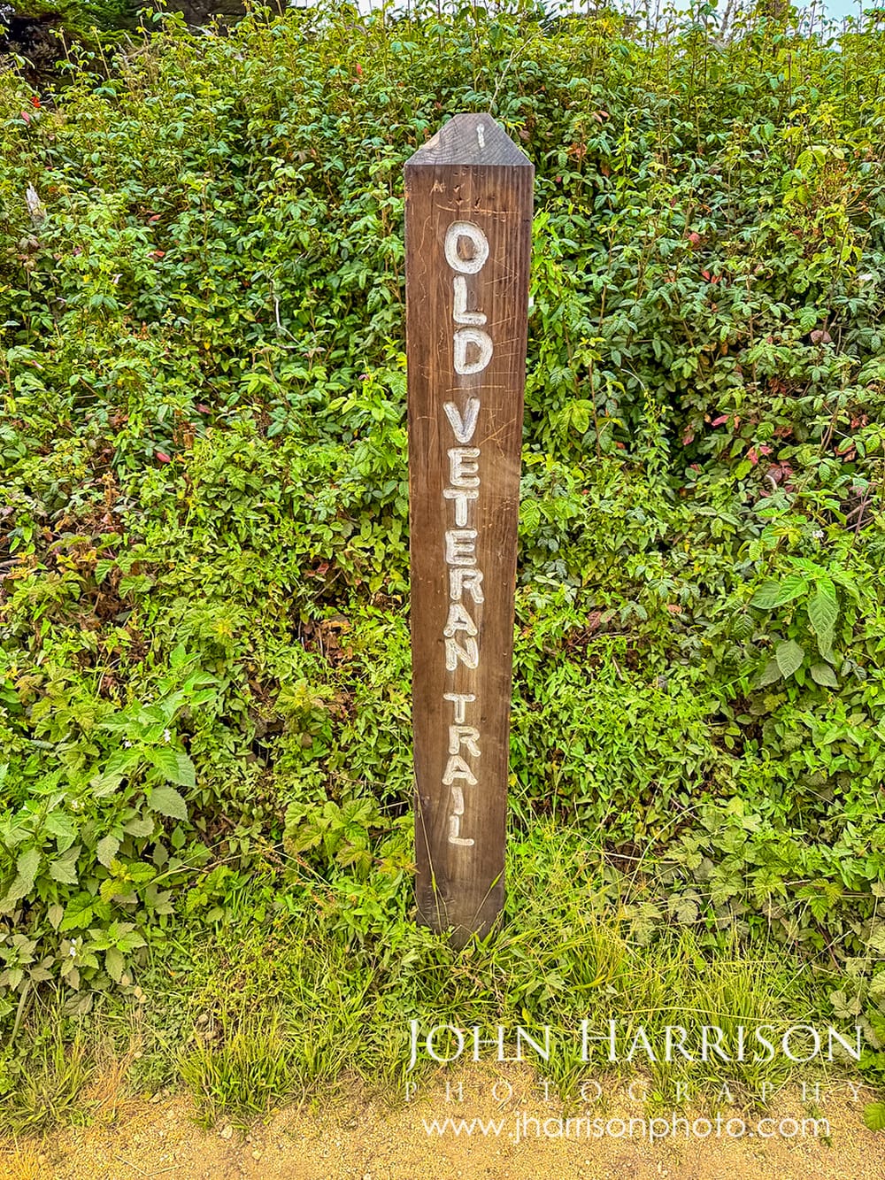](https://www.jharrisonphoto.com/Landscapes/Point-Lobos-Photography/i-Zwb6qPt?ref=blog.jharrisonphoto.com)
****Look for this small Old Veteran Trail sign after exploring Cypress Grove—it’s easy to miss, but the short detour leads to the Old Veteran and a beautiful coastal overlook.**
**John's Tip:** Don't simply finish the Cypress Grove loop and leave!
From the Sea Lion Point/Cypress Grove parking area, **take the North Shore Trail and watch for the small wooden Old Veteran Trail sign.** The Old Veteran Trail is a short spur off the North Shore Trail leading to the tree and a beautiful overlook across Cypress Cove.
The tree's exact age isn't known, but it's commonly estimated at around **200 years old**. Think about that for a moment: generations of winter storms, coastal fog, salt spray and relentless Pacific winds—and it's still here.
[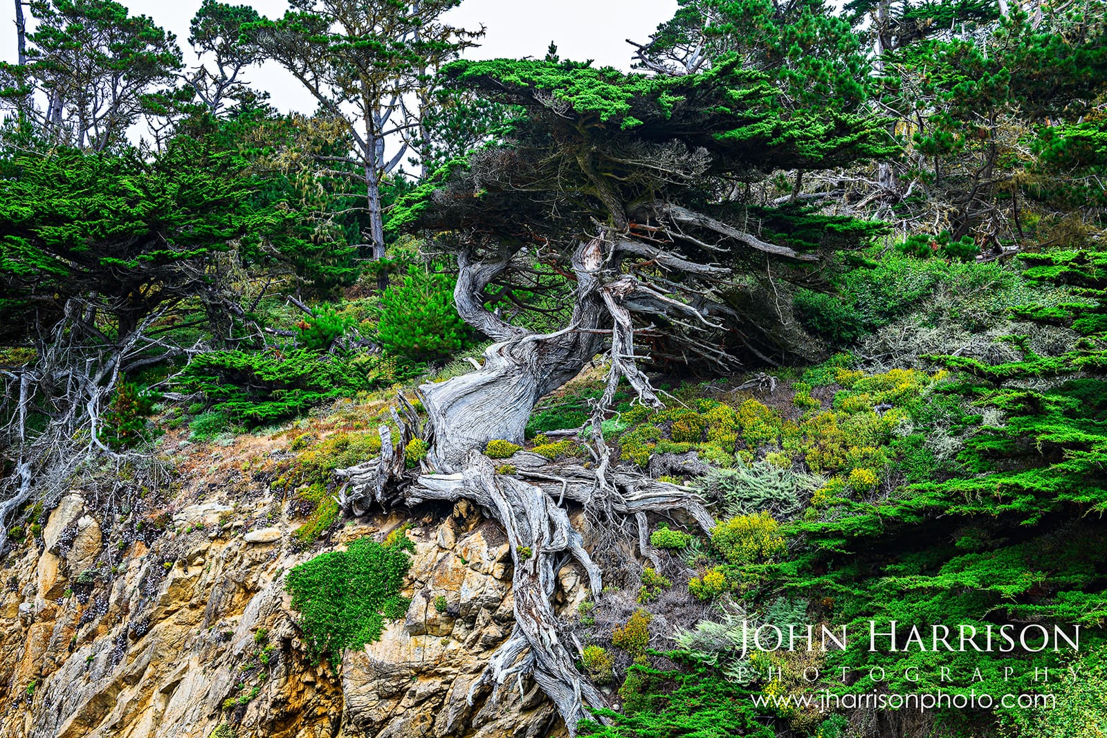](https://www.jharrisonphoto.com/Landscapes/Point-Lobos-Photography/i-QhXKzwv?ref=blog.jharrisonphoto.com)
****The Old Veteran, a centuries-old Monterey cypress clinging to the cliffs of Point Lobos.**
For me, that's what makes the Old Veteran so fascinating. It's not simply a beautiful tree. Its entire shape tells the story of surviving on this exposed stretch of the California coast.
[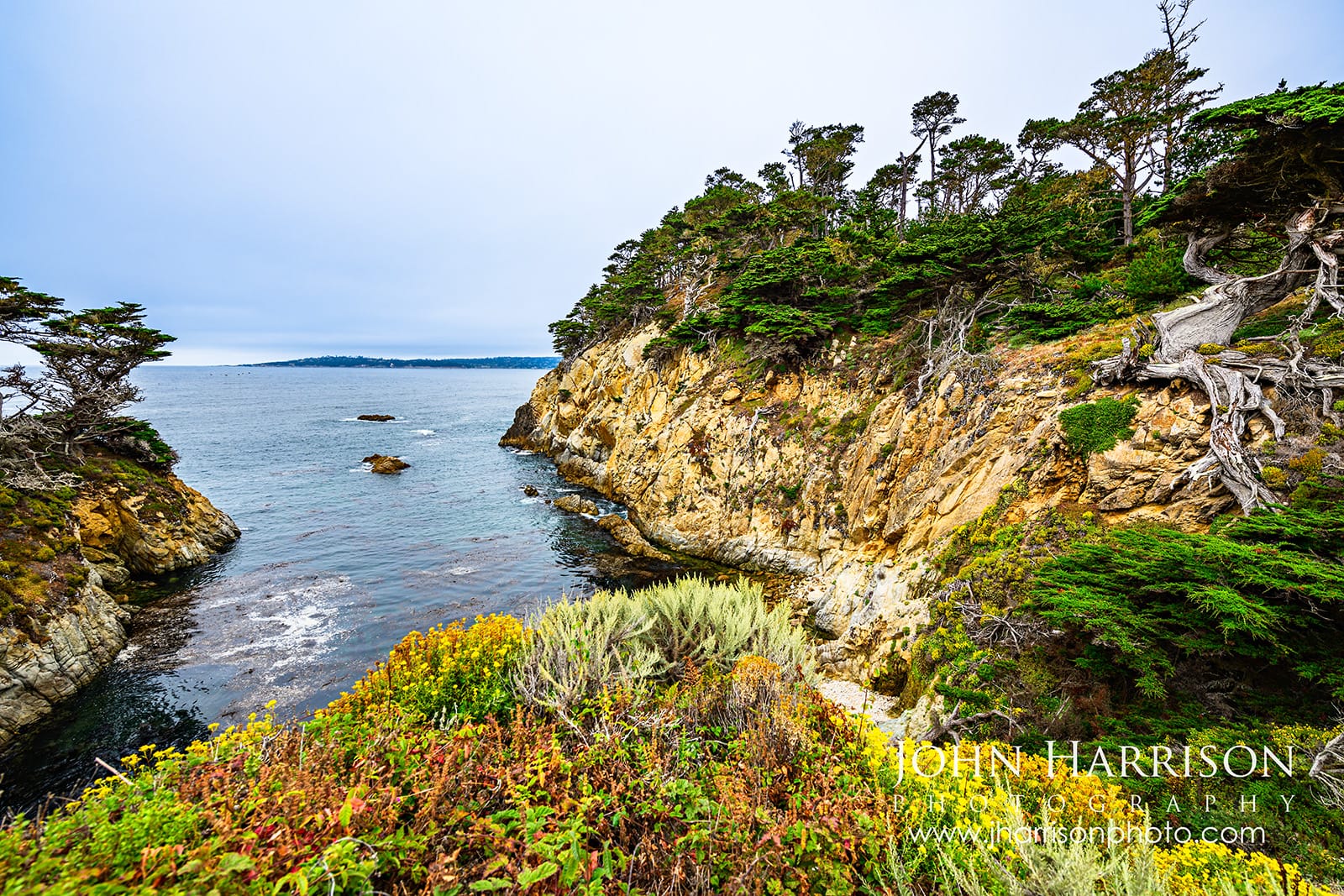](https://www.jharrisonphoto.com/Landscapes/Point-Lobos-Photography/i-hhfJn3X?ref=blog.jharrisonphoto.com)
****Just beyond the Old Veteran, the trail opens onto this beautiful rocky cove—one more reason not to turn around after completing the Cypress Grove loop.**
And don't turn around immediately after seeing the tree. The trail also opens onto a wonderful view across **Cypress Cove**, surrounded by rugged cliffs and windswept Monterey cypress.
**Navigation tip:** The Old Veteran can be easy to miss on a quick walk. I recommend using a detailed trail map rather than relying solely on a general Google map. [AllTrails Point Lobos trail maps](https://www.alltrails.com/parks/us/california/point-lobos-state-natural-reserve?ref=blog.jharrisonphoto.com) are useful for seeing the network of trails. The [Point Lobos Foundation North Shore Trail guide](https://www.pointlobos.org/trails/north-shore-trail/?ref=blog.jharrisonphoto.com) specifically identifies the Old Veteran Trail.
**Accessibility note:** The Point Lobos Foundation says the route **from the Sea Lion Point parking area to the Old Veteran Cypress is wheelchair accessible.** However, if you're considering continuing along the full **1.4-mile North Shore Trail**, conditions become considerably rougher and the trail is **recommended only for strong walkers**.
---
## Sea Lion Point: Sea Lions, Birds, Otters & Wildlife at Point Lobos
Point Lobos isn't simply a beautiful landscape.
**It's alive everywhere you look!**
Depending on the season and a little luck, you may encounter harbor seals, California sea lions, southern sea otters, pelicans, cormorants, shorebirds, dolphins, migrating whales and an incredible variety of coastal birds.
On my latest visit, the sea lions remained offshore, but once I slowed down and began watching the water, they were easy to spot. Birds were everywhere too—from seabirds working the rocky coastline to smaller species I might have completely missed if I hadn't stopped to look and listen.
[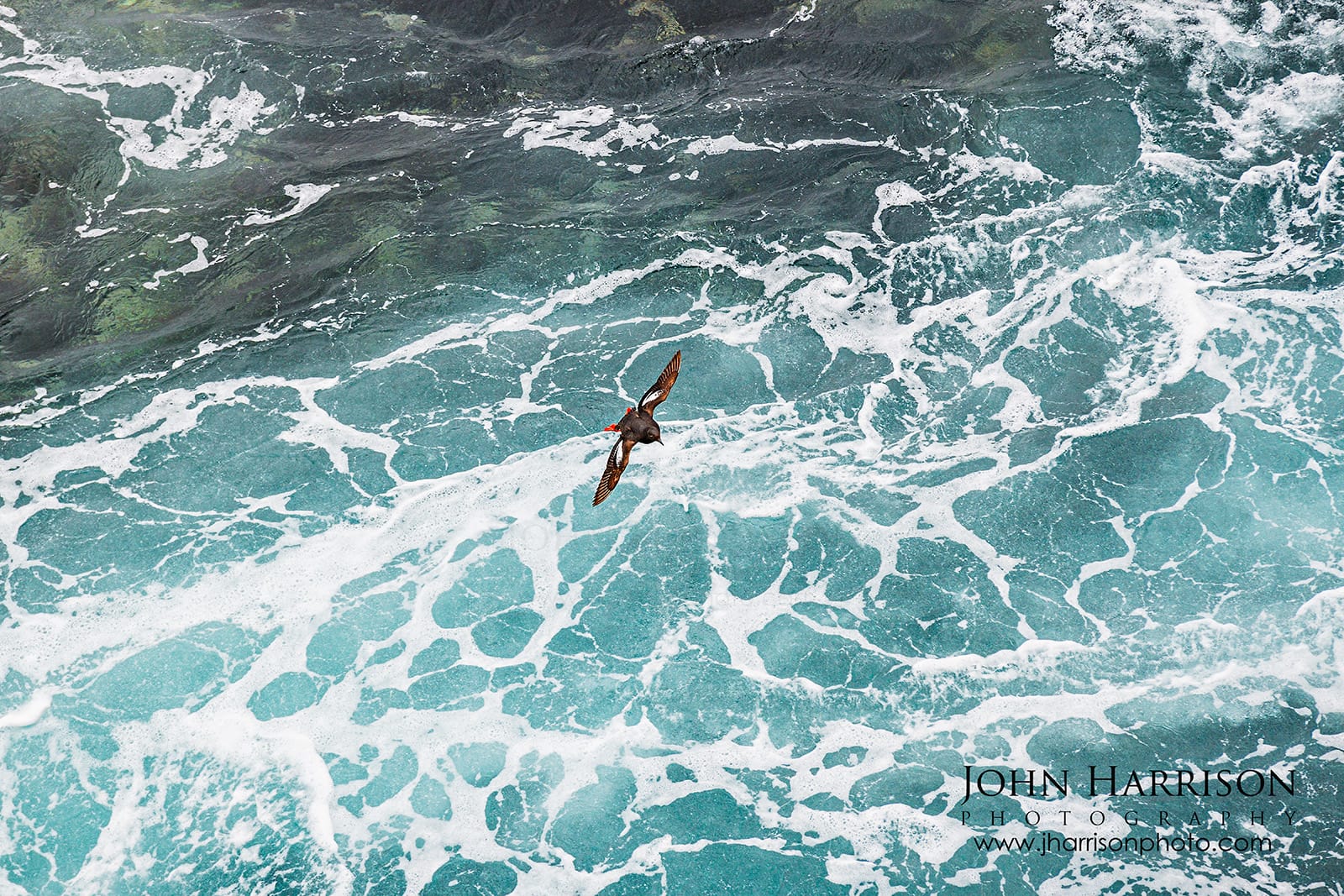](https://www.jharrisonphoto.com/Landscapes/Point-Lobos-Photography/i-jBbSN7G?ref=blog.jharrisonphoto.com)
****A Pigeon Guillemot flies above the swirling Pacific surf at Point Lobos—one of the seabirds a docent taught me to look for during my visit.**
**Don't only look for sea lions.** Scan the water for otters, watch the cliffs and offshore rocks for seabirds, and listen. Point Lobos often reveals its wildlife before you actually see it.
And if you're wondering **what you're looking at—or where to find it—ask the docents.** That became one of my favorite visitor tips from this trip.
---
## Don't Miss the Point Lobos Docent Information Station
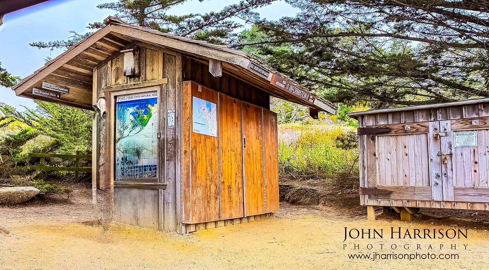
Stop at the Information Station and talk with the docents!
Seriously - do this!
Visitors can borrow binoculars, making it considerably easier to spot sea otters, seals, birds and other wildlife offshore.
On my visit, the arrangement was delightfully simple: **leave your car keys while borrowing the binoculars.**
[](https://www.jharrisonphoto.com/Landscapes/Point-Lobos-Photography/i-GNvf4WF?ref=blog.jharrisonphoto.com)
****The Point Lobos Information Station**—a great stop for maps, wildlife information, T-shirts, binoculars and local advice. Photographed after the station had closed for the day.
The docents can also tell you about current wildlife sightings, trail conditions and things happening around the reserve that you might otherwise walk straight past. One docent taught me how to recognize the **Pigeon Guillemots** I later watched flying below Sea Lion Point—exactly the kind of detail I might otherwise have missed.
**My tip: Don't just ask what you should see—ask the docents what they enjoy most about Point Lobos and what they've seen recently.**
It's a small part of the Point Lobos experience, but one I'd definitely do again.
---
## Point Lobos Photography Tips From 30+ Years of Visits
The most important photography advice I can give you here isn't a camera setting.
**Slow down.**
• Look down as often as you look toward the ocean.
• Check the tides before photographing Weston Beach
• Don't give up because the coast is foggy - I love foggy conditions!
• Overcast light can be superb for rock textures and intimate landscapes
• Keep a longer lens accessible around Bird Island and Sea Lion Point.
• A tripod can be valuable for carefully composed landscapes and moving water.
• Watch the waves before setting up near the shoreline (do NOT turn your back to the ocean!)
• Return to locations as conditions change.
• Sometimes moving the camera six inches produces a better photograph than walking another mile.
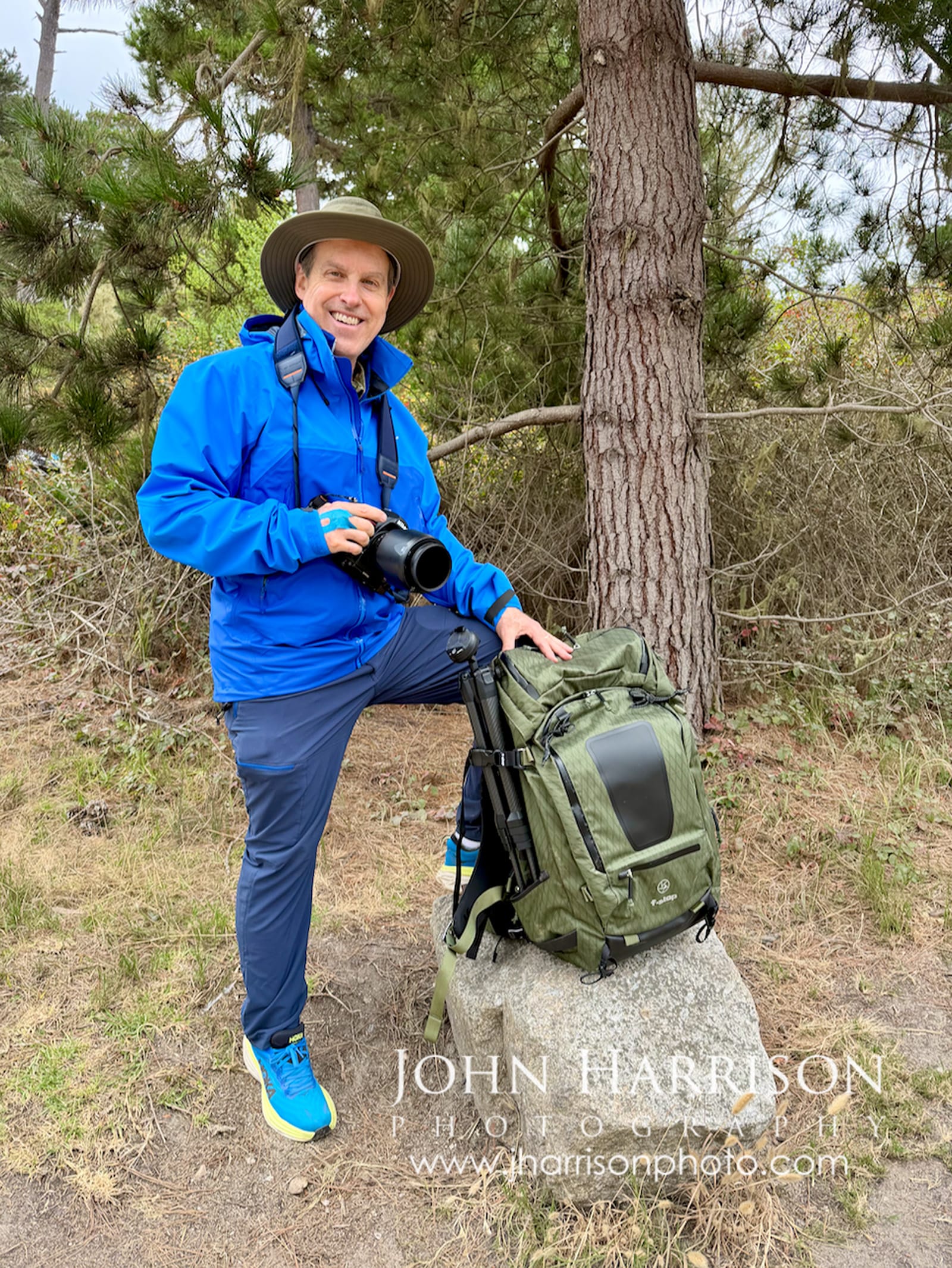
My latest visit was also the maiden field outing for my new [**Arc'teryx Beta AR Jacket**](https://amzn.to/4hQqByc?ref=blog.jharrisonphoto.com) and **f-stop Tilopa camera pack**, which carried my Nikon equipment. And yes, my blue Hoka Bondis came along too—they're still my favorites for this kind of easy walking!
[](https://www.jharrisonphoto.com/Landscapes/Point-Lobos-Photography/i-7N4DdmZ?ref=blog.jharrisonphoto.com)
John Harrison Photography with a rare moment on the other side of the camera during a full day exploring Point Lobos.
And another photographer actually took a photograph of me.
We're usually the ones missing from our own trips.
---
## How Long Should You Spend at Point Lobos?
Point Lobos rewards you most when you give it more time, but how long you need depends on what you want from the visit.
**If you have only 1 hour:** Choose one focused area—Cypress Grove + Old Veteran, Weston Beach, or China Cove. What you can realistically see will also depend on where you find parking, so don't try to see everything. Pick one area and enjoy it!
**2–4 hours:** Enough time for several of the major trails and viewpoints.
**Half day:** A very good first Point Lobos experience.
**Full day:** My recommendation for photographers, hikers and wildlife lovers.
I spent **nine hours** exploring Point Lobos on my latest visit and still wasn't particularly ready to leave.
That's probably the best endorsement I can give it.
---
## What to Bring to Point Lobos
Point Lobos is relatively easy to explore, but a few things make the experience considerably better.
• Comfortable walking shoes.
• Layers — coastal weather can change quickly, and fog or wind can arrive even on warm days.
• Plenty of water
• Breakfast or lunch for a longer visit — plan to eat at a designated picnic area.
• Camera and extra batteries
• Longer lens for wildlife
• Tripod if photography is a priority
• Binoculars—or borrow a pair from the docents
• Current tide information
I brought both breakfast and lunch on my full-day visit and stopped at one of the designated picnic areas.
That meant I didn't have to sacrifice my hard-earned parking space just because I was hungry.
---
## Point Lobos or Big Sur? Don't Choose.
If you're driving California Highway 1, I wouldn't choose between Point Lobos and Big Sur.
**Make time for both!**
Point Lobos lies just south of Carmel and naturally leads into **Garrapata State Park, Rocky Creek Bridge,** [**Bixby Bridge**](https://blog.jharrisonphoto.com/bixby-bridge-photography-big-sur/) **and the** [**heart of Big Sur**](https://blog.jharrisonphoto.com/california-coast-fine-art-photography/)**.**
But they're very different experiences.
**Big Sur overwhelms with enormous landscapes.**
**Point Lobos rewards exploration and observation.**
Together, they explain why I've continued photographing this stretch of California coastline for more than three decades.
---
## Collecting Point Lobos Fine Art Photography to Remember Your Visit
Some places photograph beautifully. Others leave a lasting impression. **Point Lobos does both.**
Point Lobos remains one of the places I return to again and again. As an award-winning fine art landscape photographer, many of the photographs featured throughout this guide are part of my fine art collection for homes, offices, hospitality and healthcare environments.
Several photographs from my **Rock Textures of Point Lobos** collection—including *Sea of Pebbles*, *Earth’s Etchings* and *Entrance to the Stones in Concert*—have become collector favorites.
*Sea of Pebbles* and *Earth’s Etchings* were also focal pieces in my former gallery installation at Rok Bistro in Silicon Valley, where additional photographs from Point Lobos continued throughout the space.
I've always found it fascinating how people respond to these images.
[](https://www.jharrisonphoto.com/Other/Residential-fine-art-installations/i-GLwdTp4/A?ref=blog.jharrisonphoto.com)
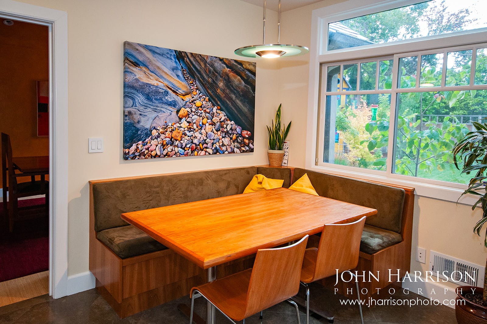
***Entrance to the Stones in Concert** **at home—a 40 × 60-inch canvas Giclée becomes the centerpiece of a collector's dining area, showing how one properly scaled photograph can completely change the character of a room.**
A sweeping California landscape may initially catch someone's attention from across a room, but these intimate compositions invite you closer.
Suddenly you're studying an individual pebble, a line through a rock, or a transition from blue into gold.
They're photographs that continue revealing new details.
**Much like Point Lobos itself.**
## Explore More of California's Coast
Continue exploring Point Lobos and California's spectacular coastline through my fine art photography collections and favorite Big Sur travel guides.
[Point Lobos Fine Art → ](https://www.jharrisonphoto.com/Landscapes/Point-Lobos-Photography?ref=blog.jharrisonphoto.com) [California Coast Collection → ](https://www.jharrisonphoto.com/Landscapes/Northern-California-Coastline?ref=blog.jharrisonphoto.com) [Bixby Bridge Guide → ](https://blog.jharrisonphoto.com/bixby-bridge-photography-big-sur/) [Big Sur Road Trip Guide → ](https://blog.jharrisonphoto.com/california-coast-fine-art-photography/)
---
## Frequently Asked Questions About Point Lobos
### Why visit Point Lobos?
Point Lobos combines an extraordinary variety of California coastal scenery within a relatively compact reserve. Visitors can explore turquoise coves, rugged Pacific cliffs, Monterey cypress forests, tide pools, beaches and wildlife while hiking trails only minutes from Carmel-by-the-Sea. It's also an ideal stop before continuing south toward Big Sur.
### Is Point Lobos worth visiting?
Absolutely. If you're visiting Carmel, Monterey or driving Highway 1 toward Big Sur, Point Lobos is one of the California coast destinations I wouldn't skip. Even a few hours gives you a very different experience from the sweeping roadside viewpoints farther south.
### How long do you need at Point Lobos?
Allow at least two to four hours for a first visit. Photographers, hikers and wildlife lovers can easily spend a full day.
### What are the best trails at Point Lobos?
For a first visit, I'd prioritize Cypress Grove Trail, Bird Island Trail and the coastal trails connecting areas such as Weston Beach and Sea Lion Point.
### What shouldn't you miss at Point Lobos?
My personal favorites are Weston Beach, China Cove, Bird Island Trail, Cypress Grove and Sea Lion Point. If you're visiting around low tide, give yourself extra time at Weston Beach.
### What is the best time to visit Point Lobos?
On busy weekends and holidays, I’d arrive **as close to opening as possible** because parking can fill remarkably quickly. Fall often brings clearer mornings and pleasantly warm afternoons, while summer frequently brings a marine layer. For photography, softer morning and late-afternoon light can be beautiful, while fog and overcast conditions are excellent for cypress trees and intimate coastal landscapes.
**Before visiting, check current opening hours, closures and visitor information on the** [**official California State Parks Point Lobos page**](https://www.parks.ca.gov/?page%5Fid=571&ref=blog.jharrisonphoto.com)**.**
### Where are the best tide pools at Point Lobos?
Weston Beach is my favorite area to explore around low tide. Check the tide schedule before your visit and always be cautious around slippery rocks and changing surf.
### Can you walk into Point Lobos for free?
**Yes. As of 2026, you can walk into Point Lobos State Natural Reserve without paying the vehicle entrance fee.** If parking inside the reserve is full, visitors can park legally outside the entrance along Highway 1 and walk in. The Point Lobos Foundation specifically provides safety guidance for visitors doing this.
Just remember that parking along Highway 1 **requires some care:** use only legal pullouts, park completely off the roadway, and be cautious walking near traffic. The reserve currently opens at **8:00 a.m.**, with the last visitor entry at **6:30 p.m.** and closing at **7:00 p.m.**
**John's Tip:** Free admission doesn't mean Point Lobos is free to operate and protect. If you walk in, consider stopping at the Information Station, talking with the volunteer docents, and supporting the Point Lobos Foundation with a donation or purchase. It's a small way to help preserve a place you're getting to enjoy for free.
**Check current Point Lobos visitor information and fees:**
[Point Lobos Foundation Visitor Information](https://www.pointlobos.org/info/?ref=blog.jharrisonphoto.com)
### Is there camping at Point Lobos?
No camping is available inside Point Lobos State Natural Reserve. Visitors planning an overnight trip should look for accommodations or campgrounds elsewhere around Carmel, Monterey or the greater Big Sur area.
### Are dogs allowed at Point Lobos?
Dogs are not permitted within Point Lobos State Natural Reserve, with exceptions for qualifying service animals under applicable park regulations.
### Can you fly a drone at Point Lobos?
**No**. Drone use is prohibited within the reserve.
### Is Point Lobos part of Big Sur?
Point Lobos sits immediately south of Carmel and north of the traditional heart of Big Sur. For a Highway 1 road trip, it makes an excellent first major nature stop before continuing toward Garrapata State Park and Bixby Bridge.
### **Why is Weston Beach at Point Lobos called Weston Beach?**
The beach is named for photographer Edward Weston, who spent years photographing Point Lobos. Ansel Adams proposed the name in his honor, and it was officially adopted in 1979\. Weston helped found Group f/64 with photographers including Ansel Adams and Imogen Cunningham, championing sharply focused images rich in texture and detail. That legacy feels especially appropriate here. Some of my favorite subjects at Weston Beach aren’t sweeping landscapes at all—they’re the patterns in the rocks, tide pools, kelp and smaller details you begin to notice when you slow down and look closely.
---
## Continue Exploring the California Coast
Point Lobos may be where I slow down, but it's only the beginning of one of America's great coastal drives.
Continue exploring:
**California Coast Road Trip: Big Sur, McWay Falls, Bixby Bridge & Hidden Gems →**
**McWay Falls in Big Sur →**
**Northern California Coastline Fine Art Photography →** [https://www.jharrisonphoto.com/Landscapes/Northern-California-Coastline](https://www.jharrisonphoto.com/Landscapes/Northern-California-Coastline?ref=blog.jharrisonphoto.com)